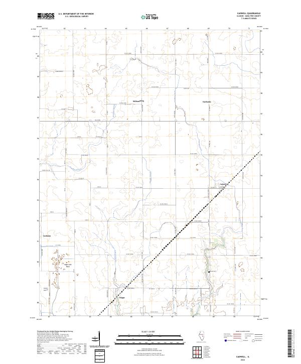
2024 Map of Cadwell
USGS Topo · Published 2024About this map
Jonathan Creek and its tributaries, including Twomile Branch and Jonathan Branch, define the agricultural landscape of this central Illinois quadrangle. The map details a persistent network of small settlements and rural junctions like Williamsburg, Fairbanks, and Cadwell, which reflect the region's long-standing reliance on decentralized farming communities. The terrain is characterized by broad drainage basins such as Eagle Lake Basin, where the low relief historically required careful water management for cultivation. Cultural landmarks of genealogical interest include the Seass Cem located near a bend in the creek and the small hamlet of Chipps at the intersection of Co RD 1600 N. The presence of Durbin Airport and Evergreen Acres indicates modern infill within an otherwise traditional prairie grid system of section-line roads like Co RD 2300n and Co HWY 10.
Find a feature on this map
62 named features on this map. Tap any name to fly to it.
Don’t see what you’re looking for? This feature index may not catch every label — zoom into the map to look around manually.
Map Details
Editions of this 2024 Cadwell Map
This is the sole edition of this map. No revisions or reprints were ever made.
Other maps of this area

1935 · Arcola
USGS Topo · 1:48,000

1935 · Sullivan
USGS Topo · 1:48,000

1940 · Sullivan
USGS Topo · 1:62,500

1940 · Arcola
USGS Topo · 1:62,500

1950 · Tuscola
USGS Topo · 1:62,500

1955 · Bement
USGS Topo · 1:62,500

1958 · Decatur
USGS Topo · 1:250,000

1961 · Decatur
USGS Topo · 1:250,000
1975 · Tuscola SW
USGS Topo · 1:24,000
1975 · Bement SE
USGS Topo · 1:24,000