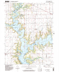
1999 Map of Kirksville
USGS Topo · Published 2003About this map
Shelbyville Lake dominates the central landscape of this 1999 survey, where the dammed waters of the Kaskaskia River and Okaw River have transformed the former river bottoms. The map documents a blend of recreation and conservation, featuring large tracts such as the West Okaw River State Fish and Wildlife Management Area, Wolf Creek State Park, and Eagle Creek State Park. Despite the expansion of the reservoir, the surrounding uplands maintain their agricultural character, punctuated by small settlements like Kirksville and Dunn. Genealogical interest is found in the numerous rural burial grounds preserved across the townships, including Thomason Cem, Hampton Cem, and Wright Cem. A notable industrial remnant is identified at the Coal Shaft Bridge, indicating the area's history of resource extraction near the river banks before the inundation of the lake.
Find a feature on this map
32 named features on this map. Tap any name to fly to it.
Don’t see what you’re looking for? This feature index may not catch every label — zoom into the map to look around manually.
Map Details
Editions of this 1999 Kirksville Map
This is the sole edition of this map. No revisions or reprints were ever made.
Other maps of this area

1935 · Sullivan
USGS Topo · 1:48,000

1940 · Sullivan
USGS Topo · 1:62,500

1942 · Shelbyville
USGS Topo · 1:62,500

1946 · Shelbyville
USGS Topo · 1:62,500

1947 · Stewardson
USGS Topo · 1:62,500

1949 · Stewardson
USGS Topo · 1:62,500

1949 · Dalton City
USGS Topo · 1:62,500

1958 · Decatur
USGS Topo · 1:250,000

1961 · Decatur
USGS Topo · 1:250,000

1980 · Middlesworth
USGS Topo · 1:24,000