
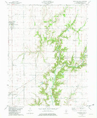
1980 Map of Middlesworth
USGS Topo · Published 1980About this map
Middletown and the surrounding agricultural landscape of central Illinois are defined by the meandering path of Salt Creek as it flows through Corwin and Hurlbut townships. This 1980 map captures the intricate drainage patterns of Pike Creek and the notable rise of Polecat Hill overlooking the creek valley. For genealogists and local historians, the sheet is exceptionally detailed in its recording of rural landmarks, including the Irish Grove Church and its adjacent Irish Grove Cemetery. The transport history of the region is evident in the presence of the Old Grade Railroad and the Icg line, which connect the small settlements of Croft and Elkhart. These rail corridors, alongside scattered resource extraction sites like the Gravel Pit, illustrate the late-twentieth-century rural economy at the border of Menard and Logan Counties.
Find a feature on this map
17 named features on this map. Tap any name to fly to it.
Don’t see what you’re looking for? This feature index may not catch every label — zoom into the map to look around manually.
Map Details
Editions of this 1980 Middlesworth Map
This is the sole edition of this map. No revisions or reprints were ever made.
Other maps of this area

1935 · Sullivan
USGS Topo · 1:48,000

1940 · Sullivan
USGS Topo · 1:62,500

1942 · Shelbyville
USGS Topo · 1:62,500

1946 · Shelbyville
USGS Topo · 1:62,500

1947 · Stewardson
USGS Topo · 1:62,500

1949 · Stewardson
USGS Topo · 1:62,500

1949 · Dalton City
USGS Topo · 1:62,500

1958 · Decatur
USGS Topo · 1:250,000

1961 · Decatur
USGS Topo · 1:250,000
1981 · Stewardson East
USGS Topo · 1:24,000