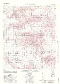
1965 Map of Cady Mountains
USGS Topo · Published 1979About this map
The Atchison Topeka and Santa Fe railroad corridor anchors this mid-century survey of the Mojave Desert, tracing a vital transport artery through the arid San Bernardino County landscape. This rail line links the small settlements of Hector and Pisgah, which serve as focal points in an otherwise sparsely populated expanse of volcanic and mountainous terrain. The southeastern portion of the map is dominated by the sprawling Lava Bed and the distinct volcanic landmark of Black Butte, illustrating the geological volatility that shaped the region.
Find a feature on this map
27 named features on this map. Tap any name to fly to it.
Don’t see what you’re looking for? This feature index may not catch every label — zoom into the map to look around manually.
Map Details
Editions of this 1965 Cady Mountains Map
This is the sole edition of this map. No revisions or reprints were ever made.
Other maps of this area

1933 · Avawatz Mountains
USGS Topo · 1:250,000

1947 · Trona
USGS Topo · 1:250,000

1948 · Trona
USGS Topo · 1:250,000

1948 · Alvord Mountain
USGS Topo · 1:62,500

1948 · Cave Mountain
USGS Topo · 1:62,500

1951 · Cave Mountain
USGS Topo · 1:62,500

1951 · Alvord Mountain
USGS Topo · 1:62,500

1953 · San Bernardino
USGS Topo · 1:250,000

1953 · Trona
USGS Topo · 1:250,000

1955 · Ludlow
USGS Topo · 1:24,000