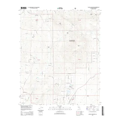
2015 Map of Cahuilla Mountain
USGS Topo · Published 2015About this map
Cahuilla Mtn and Little Cahuilla Mtn dominate this section of the San Bernardino National Forest, where high-elevation valleys and flats define the human geography. The area transitions from the rugged canyons of Bautista Canyon and Lion Canyon in the north to the more developed residential planning around Lake Riverside Estates in the south. This later-dated survey documents a landscape where traditional backcountry routes like Old Mines Trl exist alongside modern infrastructure, including the Lake Riverside Estates Airport and its accompanying Flightline Way.
Find a feature on this map
95 named features on this map. Tap any name to fly to it.
Don’t see what you’re looking for? This feature index may not catch every label — zoom into the map to look around manually.
Map Details
Editions of this 2015 Cahuilla Mountain Map
This is the sole edition of this map. No revisions or reprints were ever made.
Other maps of this area

1901 · Southern California Sheet No. 1
USGS Topo · 1:250,000

1901 · San Jacinto
USGS Topo · 1:125,000

1903 · Ramona
USGS Topo · 1:125,000

1904 · Southern California Sheet No. 2
USGS Topo · 1:250,000

1904 · Southern California Sheet No. 1
USGS Topo · 1:250,000

1939 · Warner Springs
USGS Topo · 1:62,500

1939 · Palomar Mountain
USGS Topo · 1:62,500

1940 · Hemet Reservoir
USGS Topo · 1:62,500

1942 · Hemet Reservoir
USGS Topo · 1:62,500

1942 · Hemet
USGS Topo · 1:62,500