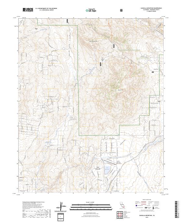
2023 Map of Cahuilla Mountain
USGS Topo · Published 2023About this map
Cahuilla Mtn dominates this high-country landscape, where the Cahuilla Mountain Wilderness protects a significant portion of the San Bernardino National Forest. The map captures a transition from the agricultural and ranching history of Reed Valley to the modern residential development at Lake Riverside. Historically significant corridors like Bautista Canyon and the South Fork San Jacinto Wilderness highlight the rugged drainage systems that define the eastern portion of the county.
Find a feature on this map
121 named features on this map. Tap any name to fly to it.
Don’t see what you’re looking for? This feature index may not catch every label — zoom into the map to look around manually.
Map Details
Editions of this 2023 Cahuilla Mountain Map
This is the sole edition of this map. No revisions or reprints were ever made.
Other maps of this area

1901 · Southern California Sheet No. 1
USGS Topo · 1:250,000

1901 · San Jacinto
USGS Topo · 1:125,000

1903 · Ramona
USGS Topo · 1:125,000

1904 · Southern California Sheet No. 2
USGS Topo · 1:250,000

1904 · Southern California Sheet No. 1
USGS Topo · 1:250,000

1939 · Warner Springs
USGS Topo · 1:62,500

1939 · Palomar Mountain
USGS Topo · 1:62,500

1940 · Hemet Reservoir
USGS Topo · 1:62,500

1942 · Hemet Reservoir
USGS Topo · 1:62,500

1942 · Hemet
USGS Topo · 1:62,500