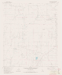
1981 Map of Cahuilla Mtn
USGS Topo · Published 1982About this map
Cahuilla Indian Reservation lands and the San Bernardino National Forest converge in this high-elevation region of Riverside County. The landscape is defined by the prominent peaks of Cahuilla Mtn and Little Cahuilla Mtn, which overlook the broad expanses of Reed Valley and Wilson Valley. Water is a critical element of the local geography, evidenced by features such as Cahuilla Lake, Lake Riverside, and several isolated springs like Duval Spring.
Find a feature on this map
35 named features on this map. Tap any name to fly to it.
Don’t see what you’re looking for? This feature index may not catch every label — zoom into the map to look around manually.
Map Details
Editions of this 1981 Cahuilla Mtn Map
3 editions found

Other maps of this area

1901 · Southern California Sheet No. 1
USGS Topo · 1:250,000

1901 · San Jacinto
USGS Topo · 1:125,000

1903 · Ramona
USGS Topo · 1:125,000

1904 · Southern California Sheet No. 2
USGS Topo · 1:250,000

1904 · Southern California Sheet No. 1
USGS Topo · 1:250,000

1939 · Warner Springs
USGS Topo · 1:62,500

1939 · Palomar Mountain
USGS Topo · 1:62,500

1940 · Hemet Reservoir
USGS Topo · 1:62,500

1942 · Hemet Reservoir
USGS Topo · 1:62,500

1942 · Hemet
USGS Topo · 1:62,500