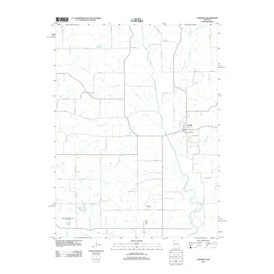
2012 Map of Cainsville
USGS Topo · Published 2012About this map
Cainsville anchors the eastern edge of this Harrison County landscape, situated along the banks of the Thompson River. The town's grid is clearly defined by local landmarks like the Cainsville Post Office and residential streets such as Depot St and Park Ave. The surrounding rural topography is defined by a dense network of tributaries, including Brush Creek, Donaby Creek, and Lost Creek, which drain into the river valley.
Find a feature on this map
67 named features on this map. Tap any name to fly to it.
Don’t see what you’re looking for? This feature index may not catch every label — zoom into the map to look around manually.
Map Details
Editions of this 2012 Cainsville Map
This is the sole edition of this map. No revisions or reprints were ever made.
Other maps of this area

1945 · Lamoni
USGS Topo · 1:62,500

1946 · Princeton
USGS Topo · 1:62,500

1947 · Lamoni
USGS Topo · 1:62,500

1947 · Blythedale
USGS Topo · 1:62,500

1948 · Princeton
USGS Topo · 1:62,500

1954 · Centerville
USGS Topo · 1:250,000

1957 · Centerville
USGS Topo · 1:250,000

1958 · Centerville
USGS Topo · 1:250,000

1964 · Pleasanton
USGS Topo · 1:24,000
1981 · Lamoni South
USGS Topo · 1:24,000