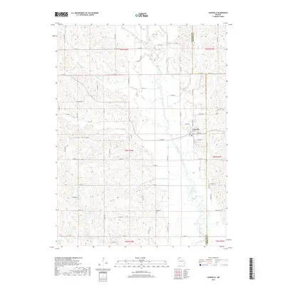
2017 Map of Cainsville
USGS Topo · Published 2017About this map
Cainsville sits at the heart of this North Missouri landscape, where the Thompson River winds south through a broad valley defined by intricate drainage networks. The terrain is marked by numerous small tributaries including Donaby Cr, Brush Cr, and Lost Cr, reflecting the complex topography of the Harrison and Mercer County border. Water management and local recreation are evident in the presence of Pelzer Lake, Reeder Lake, and Grants Lake, which break up the rural agricultural grid. A notable cultural landmark is the Bohemian Cem located in the southern portion of the quadrangle, serving as a significant site for genealogical research into the area's ethnic settlement history. The map details a dense network of secondary roads and state highways, such as State Hwy O and State Hwy B, which connect these rural homesteads and agricultural tracts to the regional hub of Cainsville.
Find a feature on this map
72 named features on this map. Tap any name to fly to it.
Don’t see what you’re looking for? This feature index may not catch every label — zoom into the map to look around manually.
Map Details
Editions of this 2017 Cainsville Map
This is the sole edition of this map. No revisions or reprints were ever made.
Other maps of this area

1945 · Lamoni
USGS Topo · 1:62,500

1946 · Princeton
USGS Topo · 1:62,500

1947 · Lamoni
USGS Topo · 1:62,500

1947 · Blythedale
USGS Topo · 1:62,500

1948 · Princeton
USGS Topo · 1:62,500

1954 · Centerville
USGS Topo · 1:250,000

1957 · Centerville
USGS Topo · 1:250,000

1958 · Centerville
USGS Topo · 1:250,000

1964 · Pleasanton
USGS Topo · 1:24,000
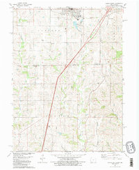
1981 · Lamoni South
USGS Topo · 1:24,000