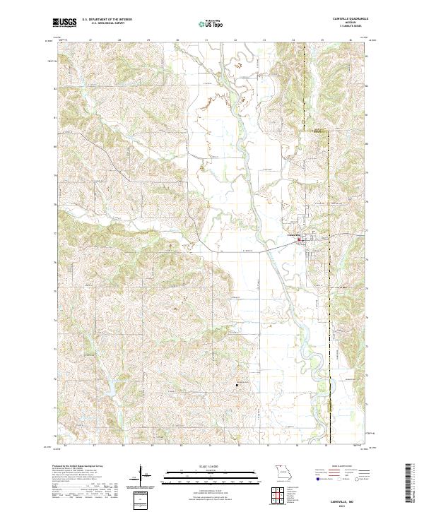
2021 Map of Cainsville
USGS Topo · Published 2021About this map
Cainsville sits at a geographic crossroads in northern Missouri, where the meandering course of the Thompson River defines the local topography. This 2021 survey illustrates a landscape of high agricultural utility and intricate drainage, with the river joined by numerous tributaries including Coal Cr, Lost Cr, and Brush Cr. The town's grid is centered near the junction of State HWY V, Main St, and Elm St, reflecting its role as a local service hub. Outside the settlement, the map reveals a rural character preserved through generations, evidenced by the Bohemian Cem and several small water bodies like Pelzer Lake and Grants Lake. The county line between Mercer and Harrison counties bisects the eastern portion of the sheet, while a dense network of secondary roads such as Akron Rd and State HWY WW connects the outlying farmsteads and creek valleys.
Find a feature on this map
49 named features on this map. Tap any name to fly to it.
Don’t see what you’re looking for? This feature index may not catch every label — zoom into the map to look around manually.
Map Details
Editions of this 2021 Cainsville Map
This is the sole edition of this map. No revisions or reprints were ever made.
Other maps of this area

1945 · Lamoni
USGS Topo · 1:62,500

1946 · Princeton
USGS Topo · 1:62,500

1947 · Lamoni
USGS Topo · 1:62,500

1947 · Blythedale
USGS Topo · 1:62,500

1948 · Princeton
USGS Topo · 1:62,500

1954 · Centerville
USGS Topo · 1:250,000

1957 · Centerville
USGS Topo · 1:250,000

1958 · Centerville
USGS Topo · 1:250,000

1964 · Pleasanton
USGS Topo · 1:24,000
1981 · Lamoni South
USGS Topo · 1:24,000