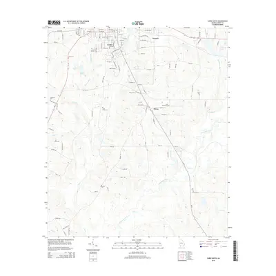
2014 Map of Cairo South
USGS Topo · Published 2014About this map
Cairo's southern grid and industrial expansions dominate the northern edge of this 2014 survey, where Us-84 cuts across the landscape near Brownlee. The terrain is defined by a dense network of tributaries, most notably Tired Cr, Little Tired Cr, and Grey Br, which all eventually feed into the Ochlockonee River as it winds through the southern half of the quadrangle. This area serves as a significant record for genealogists, featuring an unusually high concentration of rural burial grounds such as Hawthorne Cem, Sasser Cem, and the Lewis Memorial Cem near the settlement of Midway. The map captures the transition from the structured street plan of the city to a more distributed rural landscape of timber and agricultural land, interlaced with named water bodies like Lake Wight N and Wight Lake S.
Find a feature on this map
107 named features on this map. Tap any name to fly to it.
Don’t see what you’re looking for? This feature index may not catch every label — zoom into the map to look around manually.
Map Details
Editions of this 2014 Cairo South Map
This is the sole edition of this map. No revisions or reprints were ever made.
Other maps of this area

1954 · Tallahassee
USGS Topo · 1:250,000

1955 · Whigham
USGS Topo · 1:62,500

1956 · Cairo
USGS Topo · 1:62,500

1956 · Calvary
USGS Topo · 1:24,000

1957 · Beachton
USGS Topo · 1:24,000

1957 · Miccosukee NE
USGS Topo · 1:24,000

1959 · Tallahassee
USGS Topo · 1:250,000

1960 · Tallahassee
USGS Topo · 1:250,000
1974 · Pine Park
USGS Topo · 1:24,000
1974 · Whigham
USGS Topo · 1:24,000