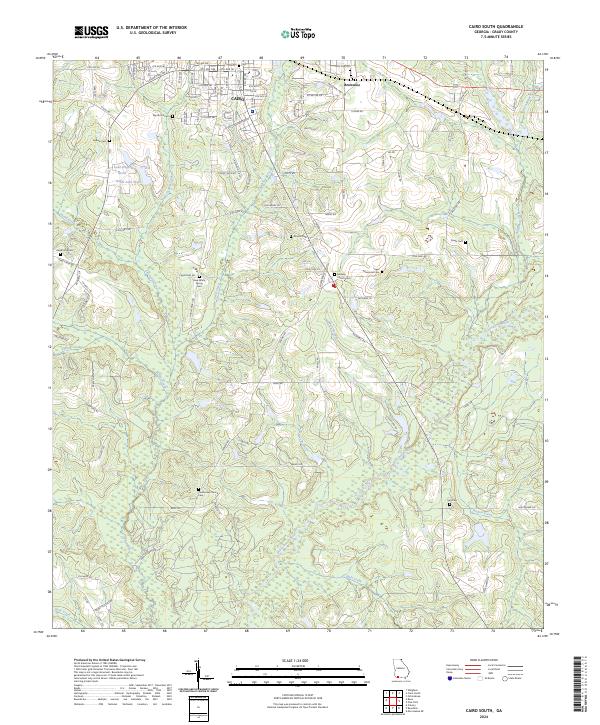
2024 Map of Cairo South
USGS Topo · Published 2024About this map
Cairo and its southern agricultural fringes dominate this landscape, where the southern reaches of the city give way to a network of creeks and timbered bottomlands. The terrain is defined by the winding course of the Ochlockonee River and its numerous tributaries, including Tired Creek and Little Tired Creek. The mapping reveals a high density of rural burial grounds and places of worship, such as Midway Church Cem and Centennial Church Cem, which serve as vital markers for family historians and genealogists. Outside the urban core of Cairo, the land is partitioned by rural routes like Calvary Rd SW and Pine Park Rd, connecting scattered residences to smaller locales like Brownlee. Notable water features such as Lake Wight North and Wight Lake South punctuate the northern section of the sheet, providing a contrast to the dense drainage patterns of the Muck Branch and Wolf Creek to the south.
Find a feature on this map
102 named features on this map. Tap any name to fly to it.
Don’t see what you’re looking for? This feature index may not catch every label — zoom into the map to look around manually.
Map Details
Editions of this 2024 Cairo South Map
This is the sole edition of this map. No revisions or reprints were ever made.
Other maps of this area

1954 · Tallahassee
USGS Topo · 1:250,000

1955 · Whigham
USGS Topo · 1:62,500

1956 · Cairo
USGS Topo · 1:62,500

1956 · Calvary
USGS Topo · 1:24,000

1957 · Beachton
USGS Topo · 1:24,000

1957 · Miccosukee NE
USGS Topo · 1:24,000

1959 · Tallahassee
USGS Topo · 1:250,000

1960 · Tallahassee
USGS Topo · 1:250,000
1974 · Pine Park
USGS Topo · 1:24,000
1974 · Whigham
USGS Topo · 1:24,000