Loading...
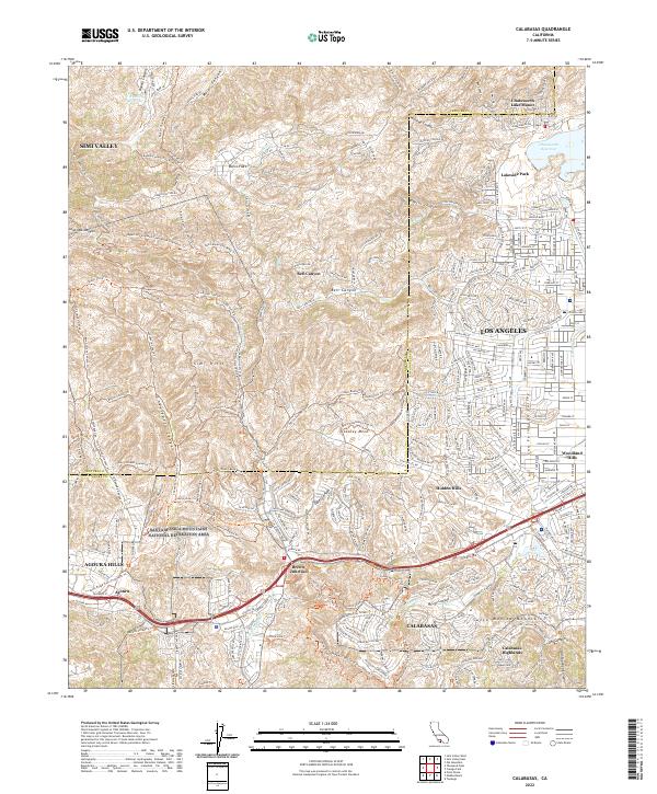
Loading map...2022 Map of Calabasas
USGS Topo · Published 2022About this map
Santa Monica Mountains National Recreation Area and the Simi Hills form a complex topographical boundary between the western San Fernando Valley and the developing foothills of Ventura County. This 2022 survey captures the modern interface of dense suburban residential blocks in Woodland Hills and Los Angeles against the protected open spaces of Laskey Mesa and Cheseboro Canyon.
Find a feature on this map
68 named features on this map. Tap any name to fly to it.
Don’t see what you’re looking for? This feature index may not catch every label — zoom into the map to look around manually.
Map Details
Date Portrayed2022
Date Published2022
PublisherU.S. Geological Survey
Map TypeTopographic
Scale1:24000
Physical Dimensions24 x 29 inches
Editions of this 2022 Calabasas Map
This is the sole edition of this map. No revisions or reprints were ever made.
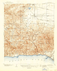
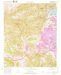
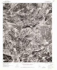
Historical Maps of Calabasas Highlands Through Time
5 maps found

Featured Locations
Source Details
SourceU.S. Geological Survey
CopyrightPublic Domain