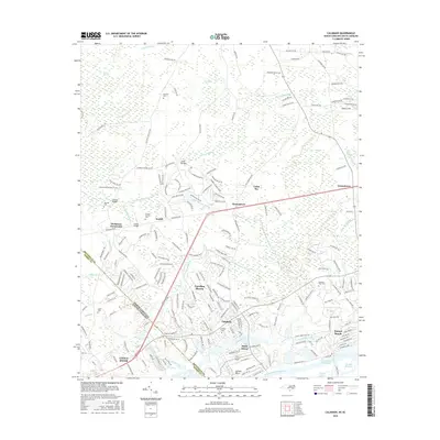
2016 Map of Calabash
USGS Topo · Published 2016About this map
The coastal transition of the North Carolina South Carolina border is defined here by the winding Intracoastal Waterway and the lowlands of Brunswick County. Dense swamp systems like Cawcaw Swamp and Scippio Swamp dominate the northern interior, while the southern reaches show the development of coastal communities including Sunset Beach and Calabash. These areas, historically shaped by the maritime economy of Little River, are marked by numerous family-named landmarks that offer significant value for genealogical research. Small, scattered burial sites such as Bennett Cem, Blanton Cem, and the Manley Bennett Cem are preserved among the modern road networks. Settlement patterns follow the higher ground between the wetlands, moving from established crossroads like Hickmans Crossroads toward the newer residential clusters of Carolina Shores. The map traces the intricate hydrography of Calabash Creek and the tidal reaches of Milliken Cove, where the land finally gives way to the Atlantic shelf.
Find a feature on this map
197 named features on this map. Tap any name to fly to it.
Don’t see what you’re looking for? This feature index may not catch every label — zoom into the map to look around manually.
Map Details
Editions of this 2016 Calabash Map
This is the sole edition of this map. No revisions or reprints were ever made.
Other maps of this area

1943 · Little River
USGS Topo · 1:31,680

1943 · Pireway
USGS Topo · 1:31,680

1943 · Calabash
USGS Topo · 1:31,680

1943 · Wampee
USGS Topo · 1:24,000

1943 · Freeland
USGS Topo · 1:24,000

1943 · Exum
USGS Topo · 1:24,000

1943 · Shallotte
USGS Topo · 1:24,000

1944 · Longs
USGS Topo · 1:31,680

1944 · Shallotte
USGS Topo · 1:31,680

1949 · Georgetown
USGS Topo · 1:250,000