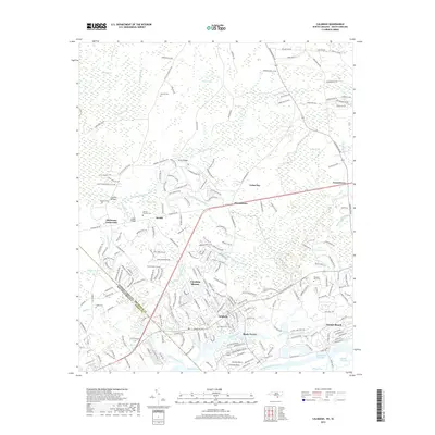
2019 Map of Calabash
USGS Topo · Published 2019About this map
Calabash and Sunset Beach sit at the southern edge of Brunswick County, where the coastal landscape is defined by the Intracoastal Waterway and a network of tidal creeks and swamps. The terrain is a complex mosaic of low-lying wetlands, including Shingletree Swamp and Cawcaw Swamp, which frame inland settlements like Thomasboro and Grissettown. This survey documents a contemporary era of residential development in towns such as Carolina Shores, yet the landscape retains deep historical roots visible in family-named landmarks like Bennett Cem and Manley Bennett Cem. Near the South Carolina border at Hickmans Crossroads, the map illustrates how roads like Ash Little River Rd NW negotiate the swampy margins of the Shallotte River. The inclusion of features like Corkins Neck and The Big Narrows provides a detailed view of the coastal geography before it transitions into the Atlantic marshes.
Find a feature on this map
213 named features on this map. Tap any name to fly to it.
Don’t see what you’re looking for? This feature index may not catch every label — zoom into the map to look around manually.
Map Details
Editions of this 2019 Calabash Map
This is the sole edition of this map. No revisions or reprints were ever made.
Other maps of this area

1943 · Little River
USGS Topo · 1:31,680

1943 · Pireway
USGS Topo · 1:31,680

1943 · Calabash
USGS Topo · 1:31,680

1943 · Wampee
USGS Topo · 1:24,000

1943 · Freeland
USGS Topo · 1:24,000

1943 · Exum
USGS Topo · 1:24,000

1943 · Shallotte
USGS Topo · 1:24,000

1944 · Longs
USGS Topo · 1:31,680

1944 · Shallotte
USGS Topo · 1:31,680

1949 · Georgetown
USGS Topo · 1:250,000