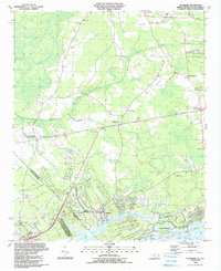
1990 Map of Calabash
USGS Topo · Published 1991About this map
Calabash and Sunset Beach anchor the southern coastal edge of this Brunswick County landscape, where the Intracoastal Waterway and the Calabash River meet near Colkins Neck. This 1990 survey captures the transition from the tidewater development of the coast to the dense marshlands and family settlements of the interior. To the north, the terrain is defined by an intricate network of wetlands, including Scippio Swamp, Cawcaw Swamp, and Shingletree Swamp.
Find a feature on this map
53 named features on this map. Tap any name to fly to it.
Don’t see what you’re looking for? This feature index may not catch every label — zoom into the map to look around manually.
Map Details
Editions of this 1990 Calabash Map
This is the sole edition of this map. No revisions or reprints were ever made.
Other maps of this area

1943 · Little River
USGS Topo · 1:31,680

1943 · Pireway
USGS Topo · 1:31,680

1943 · Calabash
USGS Topo · 1:31,680

1943 · Wampee
USGS Topo · 1:24,000

1943 · Freeland
USGS Topo · 1:24,000

1943 · Exum
USGS Topo · 1:24,000

1943 · Shallotte
USGS Topo · 1:24,000

1944 · Longs
USGS Topo · 1:31,680

1944 · Shallotte
USGS Topo · 1:31,680

1949 · Georgetown
USGS Topo · 1:250,000