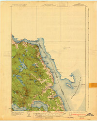
1929 Map of Calais
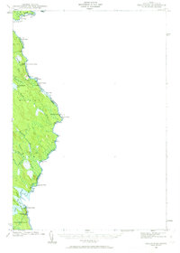
USGS Topo · Published 1964About this map
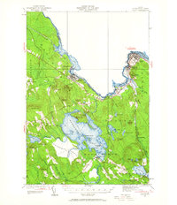
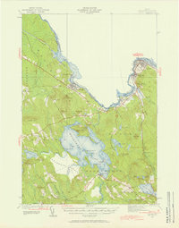
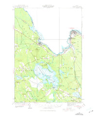
The St Croix River defines the international boundary and industrial character of this region in the late 1920s, with the riverside hubs of Woodland and Calais serving as primary anchors. The Maine Central Railroad snakes along the riverbank, connecting these mill towns to smaller stop-offs like St Croix Junc and Young Siding. Further inland, the landscape transitions to a dense network of freshwater resources dominated by the expansive Meddybemps Lake, which is dotted with named landforms like Masters Island and Hardwood Island.
Find a feature on this map
74 named features on this map. Tap any name to fly to it.
Don’t see what you’re looking for? This feature index may not catch every label — zoom into the map to look around manually.
Map Details
Editions of this 1929 Calais Map
4 editions found
Other maps of this area

1907 · Eastport
USGS Topo · 1:48,000

1908 · Eastport
USGS Topo · 1:62,500

1929 · Calais
USGS Topo · 1:48,000
1929 · Robbinston
USGS Topo · 1:48,000
1931 · Robbinston
USGS Topo · 1:62,500

1932 · Calais
USGS Topo · 1:62,500

1940 · Waite
USGS Topo · 1:62,500
1940 · Kellyland
USGS Topo · 1:62,500
1941 · Wesley
USGS Topo · 1:62,500

1941 · Gardner Lake
USGS Topo · 1:62,500