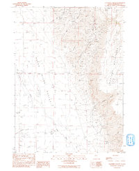
1991 Map of Calavera Canyon
USGS Topo · Published 1991About this map
The Kings River Valley serves as a stark divide between the wide basin and the soaring Montana Mountains in this high-desert Nevada landscape. Ranching and mining define the human presence here, anchored by the Rio King Ranch and the isolated Kings River Sch on the western valley floor. Numerous Prospects dot the mountain slopes, concentrated around Calavera Canyon and the Moonlight Mine, indicating a history of mineral exploration in the rugged peaks. Water management is critical in this arid environment, evidenced by the presence of Garden Ditch, Gold Hill Spring, and various stock ponds scattered near Horse Creek Spring. The geography is defined by seasonal drainages like Fivemile Creek and Ikes Creek that feed into the Kings River, which winds along the base of the mountains.
Find a feature on this map
26 named features on this map. Tap any name to fly to it.
Don’t see what you’re looking for? This feature index may not catch every label — zoom into the map to look around manually.
Map Details
Editions of this 1991 Calavera Canyon Map
This is the sole edition of this map. No revisions or reprints were ever made.
Other maps of this area

1886 · Disaster
USGS Topo · 1:250,000

1893 · Disaster
USGS Topo · 1:250,000

1954 · Vya
USGS Topo · 1:250,000

1958 · Vya
USGS Topo · 1:250,000

1961 · Quinn River Crossing
USGS Topo · 1:62,500

1961 · Thacker Pass
USGS Topo · 1:62,500

1961 · Trident Peak
USGS Topo · 1:62,500

1961 · Disaster Peak
USGS Topo · 1:62,500

1962 · Vya
USGS Topo · 1:250,000

1979 · Denio
USGS Topo · 1:100,000