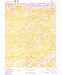
1979 Map of Calaveras Dome
USGS Topo · Published 1979About this map
The North Fork Mokelumne River carves through this high-elevation landscape where the boundaries of the Stanislaus National Forest, Eldorado National Forest, and the Mokelumne Wilderness converge. The northern portion is anchored by the Salt Springs Reservoir and its associated Powerhouse, a vital piece of water and power infrastructure. Local history and lore are evidenced by unique labels like Shovel Grave and Pumpkin Hollow, while the presence of Cuneo Camp and Ganns suggests the seasonal settlements and recreational nodes of the late 1970s.
Find a feature on this map
43 named features on this map. Tap any name to fly to it.
Don’t see what you’re looking for? This feature index may not catch every label — zoom into the map to look around manually.
Map Details
Editions of this 1979 Calaveras Dome Map
2 editions found
Other maps of this area

1889 · Pyramid Peak
USGS Topo · 1:125,000

1891 · Big Trees
USGS Topo · 1:125,000

1891 · Pyramid Peak
USGS Topo · 1:125,000

1894 · Big Trees
USGS Topo · 1:125,000

1895 · Pyramid Peak
USGS Topo · 1:125,000

1896 · Pyramid Peak
USGS Topo · 1:125,000

1897 · Big Trees
USGS Topo · 1:125,000

1901 · Big Trees
USGS Topo · 1:125,000

1947 · Sacramento
USGS Topo · 1:250,000

1948 · Sacramento
USGS Topo · 1:250,000