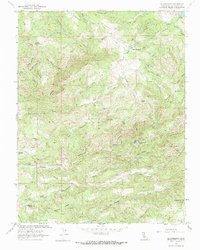
1962 Map of Calaveritas
USGS Topo · Published 1970About this map
Mountain Ranch and Calaveritas anchor this mid-century look at the Gold Country interior, where the landscape is defined by the complex drainages of Calaveritas Creek and San Antonio Creek. The map documents a legacy of extraction, showing several lode mines such as the Lucky Jim Mine, Starlet Mine, and Sunset Mine scattered across the ridgelines. The concentration of these workings near Cave City and Old Gulch highlights the enduring geological interest of the region long after the initial gold rush era.
Find a feature on this map
60 named features on this map. Tap any name to fly to it.
Don’t see what you’re looking for? This feature index may not catch every label — zoom into the map to look around manually.
Map Details
Editions of this 1962 Calaveritas Map
3 editions found
Other maps of this area

1889 · Jackson
USGS Topo · 1:125,000

1891 · Big Trees
USGS Topo · 1:125,000

1892 · Jackson
USGS Topo · 1:125,000

1894 · Big Trees
USGS Topo · 1:125,000

1897 · Jackson
USGS Topo · 1:125,000

1897 · Big Trees
USGS Topo · 1:125,000

1901 · Big Trees
USGS Topo · 1:125,000

1902 · Jackson
USGS Topo · 1:125,000

1945 · San Andreas
USGS Topo · 1:62,500

1947 · San Andreas
USGS Topo · 1:62,500