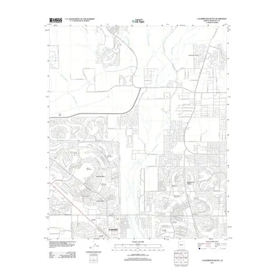
2011 Map of Calderwood Butte
USGS Topo · Published 2011About this map
Calderwood Butte rises as a prominent landmark above the rapidly expanding residential landscape of the northwestern Phoenix metropolitan area during the early 21st century. The Agua Fria River bisects the region, flanked by seasonal drainages such as Padelford Wash and Caterpillar Tank Wash. This era shows the dense suburban development of master-planned communities like Sun City West and Westbrook Village, characterized by intricate street patterns and a heavy concentration of recreational green spaces, including Stardust Golf Course and Hillcrest Golf Course.
Find a feature on this map
58 named features on this map. Tap any name to fly to it.
Don’t see what you’re looking for? This feature index may not catch every label — zoom into the map to look around manually.
Map Details
Editions of this 2011 Calderwood Butte Map
This is the sole edition of this map. No revisions or reprints were ever made.
Other maps of this area

1954 · Phoenix
USGS Topo · 1:250,000

1957 · Phoenix
USGS Topo · 1:250,000

1957 · Calderwood Butte
USGS Topo · 1:24,000

1957 · McMicken Dam
USGS Topo · 1:24,000

1957 · El Mirage
USGS Topo · 1:24,000

1957 · Waddell
USGS Topo · 1:24,000

1957 · Hedgpeth Hills
USGS Topo · 1:24,000

1957 · Glendale
USGS Topo · 1:24,000

1958 · Phoenix
USGS Topo · 1:250,000

1960 · Phoenix
USGS Topo · 1:250,000