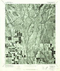
1971 Map of Calderwood Butte
USGS Topo · Published 1972About this map
Agua Fria River cuts a wide, braided path through the center of this 1971 orthophotoquad, serving as a stark dividing line between the arid desert terrain and the burgeoning suburban development of the West Valley. This aerial perspective, captured just before the explosive growth of the late 20th century, shows the early footprints of Sun City and Surprise. The map reveals a transition in land use, where traditional agricultural plots and desert scrub are being overtaken by the characteristic circular and grid-like street patterns of retirement communities and residential subdivisions. To the north, the prominent silhouette of Calderwood Butte rises above the valley floor, providing a fixed natural landmark amidst a landscape undergoing rapid human transformation.
Find a feature on this map
4 named features on this map. Tap any name to fly to it.
Don’t see what you’re looking for? This feature index may not catch every label — zoom into the map to look around manually.
Map Details
Editions of this 1971 Calderwood Butte Map
This is the sole edition of this map. No revisions or reprints were ever made.
Other maps of this area

1954 · Phoenix
USGS Topo · 1:250,000

1957 · Phoenix
USGS Topo · 1:250,000

1957 · Calderwood Butte
USGS Topo · 1:24,000

1957 · McMicken Dam
USGS Topo · 1:24,000

1957 · El Mirage
USGS Topo · 1:24,000

1957 · Waddell
USGS Topo · 1:24,000

1957 · Hedgpeth Hills
USGS Topo · 1:24,000

1957 · Glendale
USGS Topo · 1:24,000

1958 · Phoenix
USGS Topo · 1:250,000

1960 · Phoenix
USGS Topo · 1:250,000