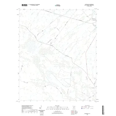
2020 Map of Calfpen Bay
USGS Topo · Published 2020About this map
Gillisonville sits at the northern edge of a landscape defined by an intricate network of wetlands and seasonal drainages in Jasper County. This modern survey captures the persistence of the Lowcountry terrain, where the vast Great Swamp and Calfpen Bay dominate the central and southern reaches of the quadrangle. The drainage pattern is marked by numerous branches and creeks, including Savannah Br, Beaverdam Br, and Elbo Cr, which feed into the larger swamp systems. A series of long-established transit routes, such as Calf Pen Bay Rd and Tarboro Rd, cut through the dense vegetation, connecting isolated settlements to the larger region. The nomenclature of the road network, featuring names like Davant Plantation Dr and Derry Plantation Truck Rd, reflects the deep-rooted agricultural and land-ownership history of this part of South Carolina.
Find a feature on this map
26 named features on this map. Tap any name to fly to it.
Don’t see what you’re looking for? This feature index may not catch every label — zoom into the map to look around manually.
Map Details
Editions of this 2020 Calfpen Bay Map
This is the sole edition of this map. No revisions or reprints were ever made.
Other maps of this area

1918 · Yemassee
USGS Topo · 1:62,500

1919 · Pineland
USGS Topo · 1:62,500

1920 · Hardeeville
USGS Topo · 1:62,500

1920 · Okatie
USGS Topo · 1:62,500

1942 · Okatie
USGS Topo · 1:62,500

1943 · Pineland
USGS Topo · 1:62,500

1943 · Hardeeville
USGS Topo · 1:62,500

1943 · Yemassee
USGS Topo · 1:62,500

1947 · Savannah
USGS Topo · 1:250,000

1948 · Savannah
USGS Topo · 1:250,000