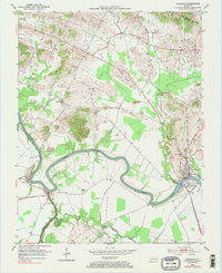
1952 Map of Calhoun
USGS Topo · Published 1983About this map
The Green River carves a winding path through McLean County, anchoring a landscape defined by riverside settlements and rural crossroads during the early 1950s. Calhoun, the county seat, sits on the northern bank across from Rumsey, while the smaller communities of Ashbyburg and Jewel City occupy the river's southern bends. The interior terrain is punctuated by significant local landmarks such as Antioch Ch, Shutts Chapel, and the uniquely named settlement of Poverty. An active petroleum economy is evident from the concentration of Oil Wells in the northeast near Guffie, showing the region's mid-century industrial footprint alongside established family history sites like Moseley Cem and Calhoun Cemetery.
Find a feature on this map
27 named features on this map. Tap any name to fly to it.
Don’t see what you’re looking for? This feature index may not catch every label — zoom into the map to look around manually.
Map Details
Editions of this 1952 Calhoun Map
Other maps of this area

1906 · Sutherland
USGS Topo · 1:62,500

1908 · Calhoun
USGS Topo · 1:62,500

1909 · Madisonville
USGS Topo · 1:62,500

1909 · Central City
USGS Topo · 1:62,500

1952 · Livermore
USGS Topo · 1:24,000

1952 · Sacramento
USGS Topo · 1:24,000

1952 · Calhoun
USGS Topo · 1:24,000

1952 · Beech Grove
USGS Topo · 1:24,000

1952 · Hanson
USGS Topo · 1:24,000
1953 · Glenville
USGS Topo · 1:24,000