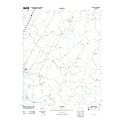
2010 Map of Calhoun
USGS Topo · Published 2010About this map
The Hiwassee River anchors this study of McMinn and Bradley counties, winding through a landscape defined by prominent river bends and steep ridges. Near the settlement of Calhoun, the river carves out Bates Bend and Hambright Bend, creating low-lying land punctuated by local landmarks like Henegar Bluff. This area preserves an extensive record of early community life through its numerous family and church burial grounds. Notable sites include the Shiloh Presbyterian Cemetery and the Calhoun Community Cemetery, along with smaller family plots like the Womack Cemetery and Britton Cemetery. The terrain transitions from the Oostanaula Valley in the north toward the elevations of Gettys Ridge and Mouse Creek Ridge, illustrating the traditional valley-and-ridge settlement patterns common to East Tennessee. Local history researchers will find a high density of named hollows and knobs, such as Swafford Knob and Dogwood Hollow, which often reflect the surnames of the area's early residents.
Find a feature on this map
98 named features on this map. Tap any name to fly to it.
Don’t see what you’re looking for? This feature index may not catch every label — zoom into the map to look around manually.
Map Details
Editions of this 2010 Calhoun Map
This is the sole edition of this map. No revisions or reprints were ever made.
Other maps of this area

1886 · Cleveland
USGS Topo · 1:125,000

1892 · Cleveland
USGS Topo · 1:125,000

1895 · Cleveland
USGS Topo · 1:125,000

1901 · Cleveland
USGS Topo · 1:125,000

1935 · East Cleveland
USGS Topo · 1:24,000

1935 · Calhoun
USGS Topo · 1:24,000

1935 · Benton
USGS Topo · 1:24,000

1935 · Athens
USGS Topo · 1:24,000

1935 · Goodfield
USGS Topo · 1:24,000

1935 · Charleston
USGS Topo · 1:24,000