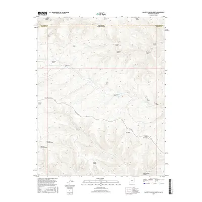
2017 Map of Caliente Canyon North
USGS Topo · Published 2017About this map
The high canyons along the Colorado-New Mexico state line dominate this 2017 survey of the border region between Las Animas and Colfax counties. The Canadian River cuts through the center of the sheet, carving a deep path through the plateau where it is joined by several drainage systems. Historical local presence is centered at the Catskill Cem, located near the northern banks of the river, which remains a key landmark for genealogists and local historians tracing the area's early ranching and settlement history.
Find a feature on this map
29 named features on this map. Tap any name to fly to it.
Don’t see what you’re looking for? This feature index may not catch every label — zoom into the map to look around manually.
Map Details
Editions of this 2017 Caliente Canyon North Map
This is the sole edition of this map. No revisions or reprints were ever made.
Other maps of this area

1891 · Spanish Peaks
USGS Topo · 1:125,000

1893 · Spanish Peaks
USGS Topo · 1:125,000

1895 · Spanish Peaks
USGS Topo · 1:125,000

1897 · Spanish Peaks
USGS Topo · 1:125,000

1900 · Spanish Peaks
USGS Topo · 1:125,000

1915 · Brilliant
USGS Topo · 1:62,500

1951 · Valdez
USGS Topo · 1:24,000

1954 · Raton
USGS Topo · 1:250,000

1954 · Trinidad
USGS Topo · 1:250,000

1955 · Trinidad
USGS Topo · 1:250,000