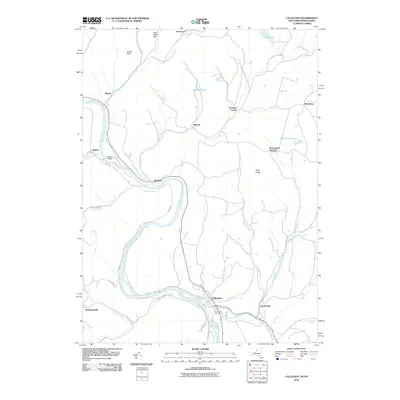
2010 Map of Callicoon
USGS Topo · Published 2010About this map
The Delaware River carves a deep path through the Upper Delaware Valley in this 2010 survey of the New York-Pennsylvania border. Centered on the riverside settlement of Callicoon, the landscape reveals a series of small rural communities and family-named landmarks. The terrain transitions from the river's edge to prominent high points like Sam Miller Hill and the plateau of Long Ridge. A network of smaller waterways, including Calkins Creek and Hankins Creek, feeds into the main river channel, defining the locations of crossroads settlements such as Fremont Center and Hortonville. Local history is anchored by sites like Holy Cross Cemetery and the spanning of the water at Kellams Bridge, which connects the Pennsylvania side to New York's Stalker and Hankins.
Find a feature on this map
39 named features on this map. Tap any name to fly to it.
Don’t see what you’re looking for? This feature index may not catch every label — zoom into the map to look around manually.
Map Details
Editions of this 2010 Callicoon Map
This is the sole edition of this map. No revisions or reprints were ever made.
Other maps of this area

1920 · Long Eddy
USGS Topo · 1:62,500

1920 · Damascus
USGS Topo · 1:62,500

1921 · Long Eddy
USGS Topo · 1:48,000

1921 · Livingston Manor
USGS Topo · 1:62,500

1922 · White Lake
USGS Topo · 1:62,500

1923 · Damascus
USGS Topo · 1:62,500

1923 · Long Eddy
USGS Topo · 1:62,500

1923 · Livingston Manor
USGS Topo · 1:62,500

1942 · White Lake
USGS Topo · 1:62,500

1943 · Honesdale
USGS Topo · 1:125,000