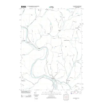
2013 Map of Callicoon
USGS Topo · Published 2013About this map
The Delaware River forms a winding border between New York and Pennsylvania, defining the character of this river valley landscape. Along its banks and the surrounding highlands, a network of small settlements like Callicoon, Hankins, and Stalker reflect the rural development of the region. The map shows a transition from the lower valley floors to the higher elevations of Sam Miller Hill and Long Ridge, with numerous creeks such as Calkins Cr and Hankins Cr draining toward the main river. Local history is anchored in sites like Saint Mary's Cem near Obernburg and Holy Cross Cem on the outskirts of Callicoon. This survey details the complex system of local routes, including Kellams Bridge and Old Long Eddy Rd, which historically connected these hillside communities and river crossings.
Find a feature on this map
122 named features on this map. Tap any name to fly to it.
Don’t see what you’re looking for? This feature index may not catch every label — zoom into the map to look around manually.
Map Details
Editions of this 2013 Callicoon Map
This is the sole edition of this map. No revisions or reprints were ever made.
Other maps of this area

1920 · Long Eddy
USGS Topo · 1:62,500

1920 · Damascus
USGS Topo · 1:62,500

1921 · Long Eddy
USGS Topo · 1:48,000

1921 · Livingston Manor
USGS Topo · 1:62,500

1922 · White Lake
USGS Topo · 1:62,500

1923 · Damascus
USGS Topo · 1:62,500

1923 · Long Eddy
USGS Topo · 1:62,500

1923 · Livingston Manor
USGS Topo · 1:62,500

1942 · White Lake
USGS Topo · 1:62,500

1943 · Honesdale
USGS Topo · 1:125,000