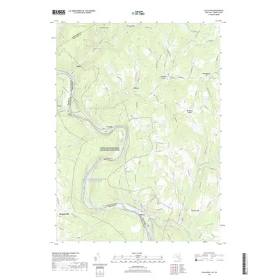
2019 Map of Callicoon
USGS Topo · Published 2019About this map
The Delaware River carves a deep valley through this borderland, serving as the primary boundary between Pennsylvania and New York. Along the river's winding course, protected lands including the Upper Delaware Scenic and Recreational River and the Upper Delaware Wild and Scenic River underscore the environmental and recreational significance of the watershed. Steep hills like Sam Miller Hill and Hawks Nest rise sharply from the water, creating a landscape of high ridges and narrow creek valleys such as Basket Creek and Hankins Cr.
Find a feature on this map
119 named features on this map. Tap any name to fly to it.
Don’t see what you’re looking for? This feature index may not catch every label — zoom into the map to look around manually.
Map Details
Editions of this 2019 Callicoon Map
This is the sole edition of this map. No revisions or reprints were ever made.
Other maps of this area

1920 · Long Eddy
USGS Topo · 1:62,500

1920 · Damascus
USGS Topo · 1:62,500

1921 · Long Eddy
USGS Topo · 1:48,000

1921 · Livingston Manor
USGS Topo · 1:62,500

1922 · White Lake
USGS Topo · 1:62,500

1923 · Damascus
USGS Topo · 1:62,500

1923 · Long Eddy
USGS Topo · 1:62,500

1923 · Livingston Manor
USGS Topo · 1:62,500

1942 · White Lake
USGS Topo · 1:62,500

1943 · Honesdale
USGS Topo · 1:125,000