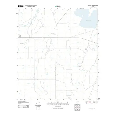
2010 Map of Calliham NW
USGS Topo · Published 2010About this map
Dragoon Oil and Gas Field and a network of ranching roads define this corner of McMullen County during the early 21st century. The landscape is characterized by intermittent drainages and man-made water features, including the Matula Lake Dam and Whitmire Lake. These structures, alongside Singer Lake and the Bracken Ranch Lake Dam, illustrate the critical importance of water management in this arid South Texas environment. The Frio River and its tributaries, such as Salt Branch and Dragoon Creek, create a natural drainage pattern across a terrain marked by named features like Black Hill Hollow. Transportation is facilitated by local routes including Teal Ranch Rd and Co Rd 309, which connect isolated ranching properties and energy production sites.
Find a feature on this map
25 named features on this map. Tap any name to fly to it.
Don’t see what you’re looking for? This feature index may not catch every label — zoom into the map to look around manually.
Map Details
Editions of this 2010 Calliham NW Map
This is the sole edition of this map. No revisions or reprints were ever made.
Other maps of this area

1920 · Mikeska
USGS Topo · 1:125,000

1925 · Simmons No. 1
USGS Topo · 1:48,000

1925 · Tilden No. 1
USGS Topo · 1:48,000

1925 · Crowther No. 3
USGS Topo · 1:48,000

1925 · Simmons No. 2
USGS Topo · 1:48,000

1929 · Simmons
USGS Topo · 1:62,500

1930 · Tilden
USGS Topo · 1:62,500

1930 · Whitsett
USGS Topo · 1:62,500

1942 · Tilden
USGS Topo · 1:62,500

1942 · Whitsett
USGS Topo · 1:62,500