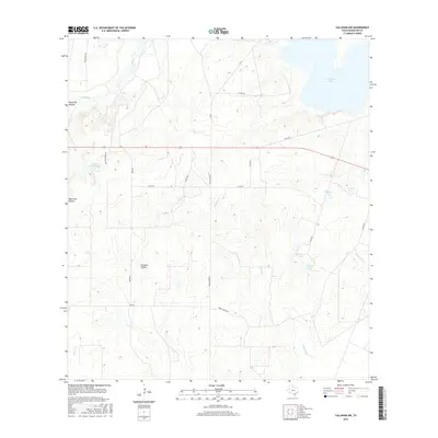
2016 Map of Calliham NW
USGS Topo · Published 2016About this map
Frio River and Salt Br shape the low-lying wetlands of this South Texas landscape in McMullen County. The terrain is characterized by a series of significant lakes and basins, most notably Yarbrough Lake in the northeast and Bracken Ranch Lake to the west. Local family and ranch names are preserved through a network of rural roads such as Mcclaugherty, Zavisch, and Wentz Ranch Rd. Deep topographic depressions, identified as Black Hill Hollow and Dragoon Hollow, highlight the natural drainage patterns that feed into southern water bodies like Singer Lake and Whitmire Lake. This map captures a vast ranchland environment defined more by its water sources and topography than by dense residential development, reflecting the enduring rural character of the region.
Find a feature on this map
27 named features on this map. Tap any name to fly to it.
Don’t see what you’re looking for? This feature index may not catch every label — zoom into the map to look around manually.
Map Details
Editions of this 2016 Calliham NW Map
This is the sole edition of this map. No revisions or reprints were ever made.
Other maps of this area

1920 · Mikeska
USGS Topo · 1:125,000

1925 · Simmons No. 1
USGS Topo · 1:48,000

1925 · Tilden No. 1
USGS Topo · 1:48,000

1925 · Crowther No. 3
USGS Topo · 1:48,000

1925 · Simmons No. 2
USGS Topo · 1:48,000

1929 · Simmons
USGS Topo · 1:62,500

1930 · Tilden
USGS Topo · 1:62,500

1930 · Whitsett
USGS Topo · 1:62,500

1942 · Tilden
USGS Topo · 1:62,500

1942 · Whitsett
USGS Topo · 1:62,500