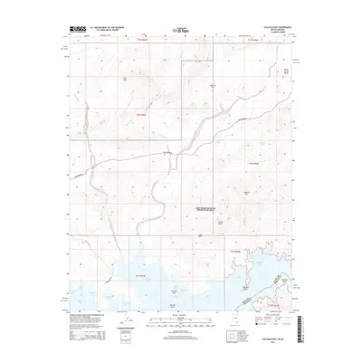
2014 Map of Callville Bay
USGS Topo · Published 2014About this map
Callville Bay and the northern reaches of Lake Mead dominate this desert landscape, where the waters of Boulder Basin meet the dramatic geological formations of Clark County. The map details a complex shoreline of inlets including Swallow Bay, Hamblin Bay, and numerous small coves like Water Barge Cove and Lovers Cove. This 2014 survey illustrates the intersection of recreation and arid wilderness within the Lake Mead National Recreation Area, where Northshore Rd serves as the primary artery through the desert.
Find a feature on this map
45 named features on this map. Tap any name to fly to it.
Don’t see what you’re looking for? This feature index may not catch every label — zoom into the map to look around manually.
Map Details
Editions of this 2014 Callville Bay Map
This is the sole edition of this map. No revisions or reprints were ever made.
Other maps of this area

1886 · Saint Thomas
USGS Topo · 1:250,000

1893 · Saint Thomas
USGS Topo · 1:250,000

1926 · Boulder Canyon
USGS Topo · 1:96,000

1952 · Dry Lake
USGS Topo · 1:62,500

1952 · Henderson
USGS Topo · 1:62,500

1953 · Muddy Peak
USGS Topo · 1:62,500

1953 · Hoover Dam
USGS Topo · 1:62,500

1954 · Las Vegas
USGS Topo · 1:250,000

1957 · Las Vegas
USGS Topo · 1:250,000

1959 · Las Vegas
USGS Topo · 1:250,000