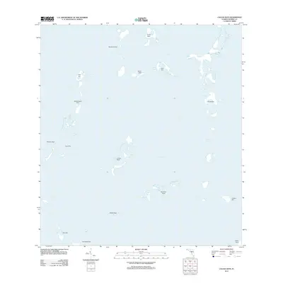
2012 Map of Calusa Keys
USGS Topo · Published 2012About this map
Florida Bay dominates this coastal survey, where a complex archipelago of mangrove islands and keys forms a intricate marine environment in Monroe County, Florida. The map illustrates a distinctive maritime geography defined by individual named landforms such as Calusa Keys, Bob Allen Keys, and Russell Key. This area represents a wilderness of shallow waters and tidal flats, where navigation is guided by features like Jimmie Channel. Unlike more developed coastal regions, this portion of the Florida coast remains focused on its natural topography, showing the varied shapes of island chains including the Samphire Keys, Triplet Keys, and Whipray Keys. The arrangement of these keys reveals the subtle shifts in the submerged landscape that have shaped local fishing and navigation for generations.
Find a feature on this map
18 named features on this map. Tap any name to fly to it.
Don’t see what you’re looking for? This feature index may not catch every label — zoom into the map to look around manually.
Map Details
Editions of this 2012 Calusa Keys Map
This is the sole edition of this map. No revisions or reprints were ever made.
Other maps of this area

1956 · Miami
USGS Topo · 1:250,000

1958 · Miami
USGS Topo · 1:250,000

1971 · Upper Matecumbe Key
USGS Topo · 1:24,000

1971 · Tavernier
USGS Topo · 1:24,000

1971 · Plantation Key
USGS Topo · 1:24,000

1972 · Madeira Bay
USGS Topo · 1:24,000

1972 · Pelican Keys
USGS Topo · 1:24,000

1972 · West Lake
USGS Topo · 1:24,000

1972 · Buchanan Keys
USGS Topo · 1:24,000

1972 · Calusa Keys
USGS Topo · 1:24,000