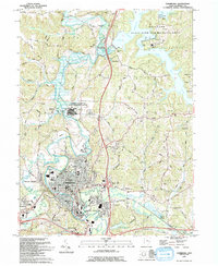
1993 Map of Cambridge
USGS Topo · Published 1994About this map
Cambridge serves as the industrial and civic anchor of this Guernsey County landscape, where the urban grid of the city meets the expansive recreation grounds of Salt Fork State Park and Wildlife Area. The northern portion of the map is dominated by the sprawling Salt Fork Lake, featuring infrastructure like the Salt Fork Lodge, a Marina, and a Heliport. This era shows a significant institutional presence near the city, most notably the Cambridge State Mental Health Developmental Center and Guernsey Mem Hospital.
Find a feature on this map
62 named features on this map. Tap any name to fly to it.
Don’t see what you’re looking for? This feature index may not catch every label — zoom into the map to look around manually.
Map Details
Editions of this 1993 Cambridge Map
This is the sole edition of this map. No revisions or reprints were ever made.
Other maps of this area

1909 · Antrim
USGS Topo · 1:48,000

1909 · Summerfield
USGS Topo · 1:62,500

1909 · Cambridge
USGS Topo · 1:62,500

1911 · Antrim
USGS Topo · 1:62,500

1911 · Cumberland
USGS Topo · 1:62,500

1911 · Summerfield
USGS Topo · 1:62,500

1912 · Cambridge
USGS Topo · 1:62,500

1949 · Clarksburg
USGS Topo · 1:250,000

1951 · Canton
USGS Topo · 1:250,000

1953 · Canton
USGS Topo · 1:250,000