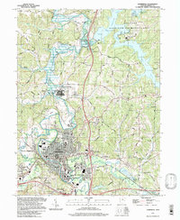
1994 Map of Cambridge
USGS Topo · Published 1998About this map
Cambridge serves as the focal point of this Ohio landscape, where the confluence of Wills Creek and Leatherwood Creek has shaped the town's development. The map reveals a transition from the urban grid of the county seat to the sprawling Salt Fork State Park and Wildlife Area in the northeast. Institutional history is prominent here, notably the large footprint of the Cambridge State Mental Health Developmental Center and the Guernsey Mem Hosp. Transportation and industry markers like Mineral Siding and numerous labeled Oil Wells and Drill Holes indicate the region's reliance on natural resources. Further out, small settlements like Tyner and Oldham remain connected by rural routes such as Old Grade Road, while the Cambridge Reservoir and Salt Fork Lake reflect the mid-century engineering that reshaped the local topography.
Find a feature on this map
64 named features on this map. Tap any name to fly to it.
Don’t see what you’re looking for? This feature index may not catch every label — zoom into the map to look around manually.
Map Details
Editions of this 1994 Cambridge Map
This is the sole edition of this map. No revisions or reprints were ever made.
Other maps of this area

1909 · Antrim
USGS Topo · 1:48,000

1909 · Summerfield
USGS Topo · 1:62,500

1909 · Cambridge
USGS Topo · 1:62,500

1911 · Antrim
USGS Topo · 1:62,500

1911 · Cumberland
USGS Topo · 1:62,500

1911 · Summerfield
USGS Topo · 1:62,500

1912 · Cambridge
USGS Topo · 1:62,500

1949 · Clarksburg
USGS Topo · 1:250,000

1951 · Canton
USGS Topo · 1:250,000

1953 · Canton
USGS Topo · 1:250,000