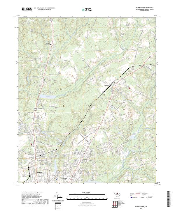
2024 Map of Camden North
USGS Topo · Published 2024About this map
Camden and its surrounding communities in Kershaw County are defined by a complex network of springs, ponds, and historical land elevations. The southern portion of the map reveals the dense residential and memorial development near Kirkwood and East Camden, where natural features like Jumelle Spring and Brevard Spring are situated. Notable elevations including Hobkirk Hill and Jumelle Hill provide geographic context to a landscape shaped by both early settlement and twentieth-century infrastructure, such as Woodward Field. Further north, the terrain transitions to a pattern of creeks and scattered settlements like Shamokin and Kirkland. The presence of numerous water bodies, including Colonial Lake, Adams Mill Pond, and Lake Shamokin, suggests a history of local water management and recreation integral to the area's development. Local cemeteries like Belton Cemetery and Forest Lawn Memorial Park provide specific points of interest for genealogists tracing regional family history.
Find a feature on this map
259 named features on this map. Tap any name to fly to it.
Don’t see what you’re looking for? This feature index may not catch every label — zoom into the map to look around manually.
Map Details
Editions of this 2024 Camden North Map
This is the sole edition of this map. No revisions or reprints were ever made.
Other maps of this area

1935 · Camden
USGS Topo · 1:48,000

1938 · Camden
USGS Topo · 1:62,500

1938 · Hagood
USGS Topo · 1:62,500

1941 · Spartanburg
USGS Topo · 1:250,000

1942 · Camden
USGS Topo · 1:125,000

1953 · Camden South
USGS Topo · 1:24,000

1953 · Lugoff
USGS Topo · 1:24,000

1953 · Spartanburg
USGS Topo · 1:250,000

1957 · Ashwood
USGS Topo · 1:62,500

1960 · Spartanburg
USGS Topo · 1:250,000