
1938 Map of Camden
USGS Topo · Published 1938About this map
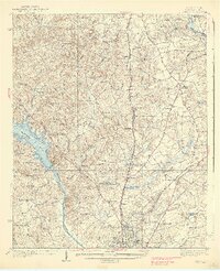
The Wateree River corridor south of Camden anchors this 1930s survey of Kershaw County, revealing a landscape transitioning between agrarian traditions and early aviation. The town of Camden serves as the regional hub, supported by the Seaboard Air Line and Southern railroads. The presence of the Camden Landing Field and a prominent Transmission Line cutting across Quarter Creek signals the modernization of the era.
Find a feature on this map
70 named features on this map. Tap any name to fly to it.
Don’t see what you’re looking for? This feature index may not catch every label — zoom into the map to look around manually.
Map Details
Editions of this 1938 Camden Map
2 editions found
Other maps of this area

1935 · Camden
USGS Topo · 1:48,000

1935 · Killian
USGS Topo · 1:48,000

1937 · Killian
USGS Topo · 1:62,500

1938 · Hagood
USGS Topo · 1:62,500

1941 · Spartanburg
USGS Topo · 1:250,000

1942 · Camden
USGS Topo · 1:125,000

1953 · Camden South
USGS Topo · 1:24,000

1953 · Lugoff
USGS Topo · 1:24,000

1953 · Blaney
USGS Topo · 1:24,000

1953 · Spartanburg
USGS Topo · 1:250,000