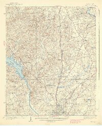
1938 Map of Camden
USGS Topo · Published 1938About this map
Camden serves as the focal point of this mid-1930s landscape, situated where the Southern railroad meets the Wateree River valley. The map reveals an area defined by its rural infrastructure, with numerous churches like McCalvary Ch and schools such as Thornhill Sch scattered across the uplands. The presence of the Camden Landing Field and a Fire Tower near Sanders Creek Ch indicates a period of modernization in transportation and forest management. Along the eastern edge, the Lynches River basin supports traditional industries, evidenced by Barfield Mill and Kirkley Mill. Significant local history is preserved in the location of Chestnut Cem and crossroads settlements like Westville and De Kalb. The landscape is a network of water and road systems, including the Wire Road and Georgetown Road, which have long guided regional movement.
Find a feature on this map
73 named features on this map. Tap any name to fly to it.
Don’t see what you’re looking for? This feature index may not catch every label — zoom into the map to look around manually.
Map Details
Editions of this 1938 Camden Map
2 editions found
Other maps of this area

1935 · Camden
USGS Topo · 1:48,000

1935 · Killian
USGS Topo · 1:48,000

1937 · Killian
USGS Topo · 1:62,500

1938 · Camden
USGS Topo · 1:62,500

1938 · Hagood
USGS Topo · 1:62,500

1941 · Spartanburg
USGS Topo · 1:250,000

1942 · Camden
USGS Topo · 1:125,000

1953 · Camden South
USGS Topo · 1:24,000

1953 · Lugoff
USGS Topo · 1:24,000

1953 · Blaney
USGS Topo · 1:24,000