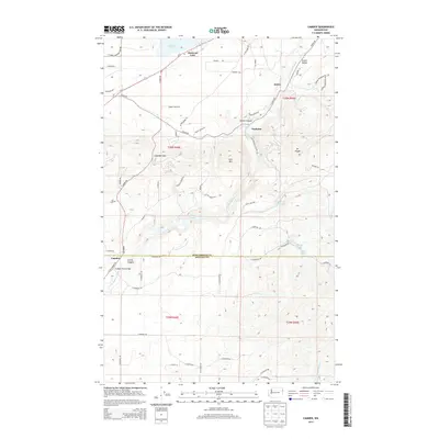
2014 Map of Camden
USGS Topo · Published 2014About this map
The Little Spokane River winds through the borderlands of Pend Oreille and Spokane Counties, defining a landscape of narrow valleys and isolated peaks. Small settlements like Scotia and Grahams sit along the drainage of Scotia Canyon, while Camden marks the southern entry to this corridor. The topography is dominated by significant elevations such as Mt Pisgah and Lone Mtn, which overlook a network of lakes including Chain Lake and the residential area around Diamond Lake. The transportation network is anchored by Us-2, connecting these rural communities. Notable local infrastructure, such as the Frideger Road Bridge, provides specific points of interest for those studying the regional development. The presence of numerous named roads like Edward Conrad Rd and Xanadu Ranch Rd reflects the modern subdivision of this timber and lake country north of Spokane.
Find a feature on this map
67 named features on this map. Tap any name to fly to it.
Don’t see what you’re looking for? This feature index may not catch every label — zoom into the map to look around manually.
Map Details
Editions of this 2014 Camden Map
This is the sole edition of this map. No revisions or reprints were ever made.
Other maps of this area

1901 · Spokane
USGS Topo · 1:125,000

1936 · Newport
USGS Topo · 1:96,000

1942 · Newport
USGS Topo · 1:125,000

1943 · Mt Spokane
USGS Topo · 1:62,500

1949 · Deer Park
USGS Topo · 1:62,500

1950 · Mt Spokane
USGS Topo · 1:62,500

1951 · Deer Park
USGS Topo · 1:62,500

1955 · Spokane
USGS Topo · 1:250,000

1958 · Spokane
USGS Topo · 1:250,000

1958 · Sandpoint
USGS Topo · 1:250,000