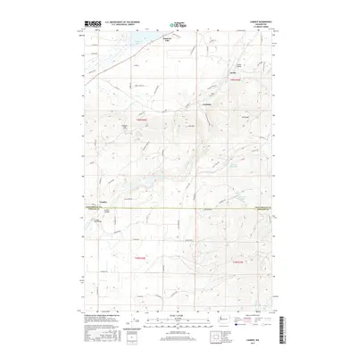
2017 Map of Camden
USGS Topo · Published 2017About this map
Diamond Lake sits at the northern edge of this Washington landscape, serving as a focal point for a region defined by the winding course of the Little Spokane River. To the south, the terrain descends through Scotia Canyon and past the high elevations of Mt Pisgah and Lone Mtn. Small settlements and rail points like Camden, Scotia, and Grahams are linked by a network of rural roads such as Wakefield Rd and Scotia Rd. The map illustrates a high concentration of water bodies including Chain Lake, Lake of the Woods, Isabelle Lake, and Lynda Lake, suggesting a low-lying valley system between the ridges. This detailed 2017 survey also marks precise infrastructure like the Frideger Road Bridge and the boundary line where Pend Oreille and Spokane counties meet, making it a critical resource for understanding the modern physical and political geography of the area.
Find a feature on this map
62 named features on this map. Tap any name to fly to it.
Don’t see what you’re looking for? This feature index may not catch every label — zoom into the map to look around manually.
Map Details
Editions of this 2017 Camden Map
This is the sole edition of this map. No revisions or reprints were ever made.
Other maps of this area

1901 · Spokane
USGS Topo · 1:125,000

1936 · Newport
USGS Topo · 1:96,000

1942 · Newport
USGS Topo · 1:125,000

1943 · Mt Spokane
USGS Topo · 1:62,500

1949 · Deer Park
USGS Topo · 1:62,500

1950 · Mt Spokane
USGS Topo · 1:62,500

1951 · Deer Park
USGS Topo · 1:62,500

1955 · Spokane
USGS Topo · 1:250,000

1958 · Spokane
USGS Topo · 1:250,000

1958 · Sandpoint
USGS Topo · 1:250,000