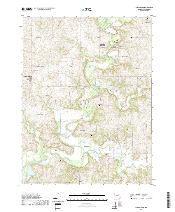
2021 Map of Camden Point
USGS Topo · Published 2021About this map
The Platte River and Little Platte River carve a meandering path through central Platte County, shaping the landscape near the settlements of Camden Point, Edgerton, and Ridgely. This modern survey reveals a region defined by its rural heritage, where family and community roots are preserved in numerous small burial grounds such as Mount Zion Cem, Chinn Cem, and Cockriel Cem. The terrain is characterized by riverine features like the Goose Neck and Slash Valley, reflecting a long history of water-driven geography.
Find a feature on this map
78 named features on this map. Tap any name to fly to it.
Don’t see what you’re looking for? This feature index may not catch every label — zoom into the map to look around manually.
Map Details
Editions of this 2021 Camden Point Map
This is the sole edition of this map. No revisions or reprints were ever made.
Other maps of this area

1890 · Kansas City
USGS Topo · 1:125,000

1894 · Kansas City
USGS Topo · 1:125,000

1910 · Leavenworth
USGS Topo · 1:62,500

1914 · Smithville
USGS Topo · 1:62,500

1925 · Gower
USGS Topo · 1:62,500

1927 · Dearborn
USGS Topo · 1:62,500
1948 · Nashua
USGS Topo · 1:24,000

1948 · Leavenworth
USGS Topo · 1:62,500

1950 · Kansas City
USGS Topo · 1:250,000
1950 · Nashua
USGS Topo · 1:24,000