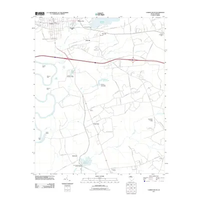
2011 Map of Camden South
USGS Topo · Published 2011About this map
Camden south into the Kershaw County countryside reveals a landscape defined by the winding Wateree River and a network of creeks that once powered local industry. The legacy of water-driven processing is evident at Hermitage Mill and Boykin Mill Pond, while the agricultural character of the era is anchored by Hermitage Farm. Significant genealogical sites are clustered near the city center and along rural routes, including the Quaker Cemetery, Jewish Cemetery, and the remote Union Cemetery. The terrain is marked by distinctive local names such as Tickle Hill and Paint Hill, while the river's path creates a series of named landforms like Friends Neck and Devils Elbow. Small settlements and landing strips like Hammond and El Porvenir Airpark punctuate the transition from the historic streets of Camden to the surrounding pine-dotted wetlands.
Find a feature on this map
96 named features on this map. Tap any name to fly to it.
Don’t see what you’re looking for? This feature index may not catch every label — zoom into the map to look around manually.
Map Details
Editions of this 2011 Camden South Map
This is the sole edition of this map. No revisions or reprints were ever made.
Other maps of this area

1935 · Camden
USGS Topo · 1:48,000

1938 · Camden
USGS Topo · 1:62,500

1938 · Hagood
USGS Topo · 1:62,500

1941 · Spartanburg
USGS Topo · 1:250,000

1942 · Camden
USGS Topo · 1:125,000

1953 · Camden South
USGS Topo · 1:24,000

1953 · Lugoff
USGS Topo · 1:24,000

1953 · Rembert
USGS Topo · 1:24,000
1953 · Leesburg
USGS Topo · 1:24,000

1953 · Spartanburg
USGS Topo · 1:250,000