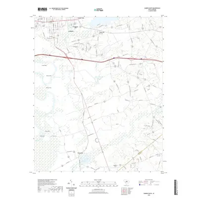
2020 Map of Camden South
USGS Topo · Published 2020About this map
Camden and its southern outskirts are defined by the transition from structured town grids to the winding wetlands of the Wateree River basin. In the northern section, the historic urban core is anchored by the Kershaw County Courthouse and significant community sites like the Quaker Cem and Jewish Cem. Industrial and recreational history is evident along the water, from Hermitage Mill near the town center to the Mulberry Picnic Pond further south.
Find a feature on this map
116 named features on this map. Tap any name to fly to it.
Don’t see what you’re looking for? This feature index may not catch every label — zoom into the map to look around manually.
Map Details
Editions of this 2020 Camden South Map
This is the sole edition of this map. No revisions or reprints were ever made.
Other maps of this area

1935 · Camden
USGS Topo · 1:48,000

1938 · Camden
USGS Topo · 1:62,500

1938 · Hagood
USGS Topo · 1:62,500

1941 · Spartanburg
USGS Topo · 1:250,000

1942 · Camden
USGS Topo · 1:125,000

1953 · Camden South
USGS Topo · 1:24,000

1953 · Lugoff
USGS Topo · 1:24,000

1953 · Rembert
USGS Topo · 1:24,000
1953 · Leesburg
USGS Topo · 1:24,000

1953 · Spartanburg
USGS Topo · 1:250,000