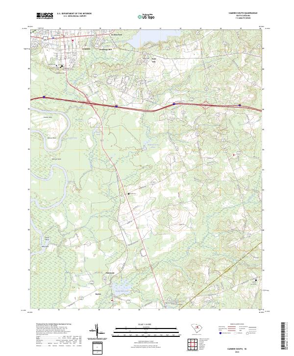
2024 Map of Camden South
USGS Topo · Published 2024About this map
Camden and its southern surroundings are defined by a complex network of waterways and a long record of settlement along the Wateree River. The landscape transitions from the urban grid of the county seat, anchored by the Kershaw County Courthouse, to the wetlands and agricultural tracts of the south. This area preserves a significant concentration of early community landmarks, including the Quaker Cem, the Old Presbyterian Burying Ground Cem, and the Bethel Jewish Cem, reflecting the diverse ancestry of the region.
Find a feature on this map
115 named features on this map. Tap any name to fly to it.
Don’t see what you’re looking for? This feature index may not catch every label — zoom into the map to look around manually.
Map Details
Editions of this 2024 Camden South Map
This is the sole edition of this map. No revisions or reprints were ever made.
Other maps of this area

1935 · Camden
USGS Topo · 1:48,000

1938 · Camden
USGS Topo · 1:62,500

1938 · Hagood
USGS Topo · 1:62,500

1941 · Spartanburg
USGS Topo · 1:250,000

1942 · Camden
USGS Topo · 1:125,000

1953 · Camden South
USGS Topo · 1:24,000

1953 · Lugoff
USGS Topo · 1:24,000

1953 · Rembert
USGS Topo · 1:24,000
1953 · Leesburg
USGS Topo · 1:24,000

1953 · Spartanburg
USGS Topo · 1:250,000