
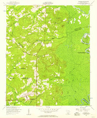
1953 Map of Camden South
USGS Topo · Published 1957About this map
The Mulberry Plantation and the industrial remnants of Hermitage Mill anchor this mid-century survey of the South Carolina Midlands. Just south of the Camden city center, the landscape transitions from urban grid to dense river lowlands and timbered ridges. Educational and religious institutions are prominent, including the Browning Home and Mather Academy and various rural landmarks like Wesley Chapel and Saint Mathew School.
Find a feature on this map
46 named features on this map. Tap any name to fly to it.
Don’t see what you’re looking for? This feature index may not catch every label — zoom into the map to look around manually.
Map Details
Editions of this 1953 Camden South Map
This is the sole edition of this map. No revisions or reprints were ever made.
Other maps of this area

1935 · Camden
USGS Topo · 1:48,000

1938 · Camden
USGS Topo · 1:62,500

1938 · Hagood
USGS Topo · 1:62,500

1941 · Spartanburg
USGS Topo · 1:250,000

1942 · Camden
USGS Topo · 1:125,000

1953 · Lugoff
USGS Topo · 1:24,000

1953 · Rembert
USGS Topo · 1:24,000
1953 · Leesburg
USGS Topo · 1:24,000

1953 · Spartanburg
USGS Topo · 1:250,000

1957 · Ashwood
USGS Topo · 1:62,500