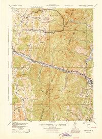
1944 Map of Camels Hump
USGS Topo · Published 1944About this map
The Green Mountains dominate this mid-century landscape, anchored by the iconic peak of Camels Hump (The Lion). Settlement is concentrated along the valleys of the Winooski River and Huntington River, where the Central Vermont railway and the Theodore Roosevelt International Highway serve as the primary conduits for travel and trade. In the north, the Fort Ethan Allen Artillery Range covers a significant portion of Underhill and Jericho, reflecting the military presence in the region during the war years.
Find a feature on this map
86 named features on this map. Tap any name to fly to it.
Don’t see what you’re looking for? This feature index may not catch every label — zoom into the map to look around manually.
Map Details
Editions of this 1944 Camels Hump Map
This is the sole edition of this map. No revisions or reprints were ever made.
Other maps of this area

1903 · Middlebury
USGS Topo · 1:62,500

1905 · Middlebury
USGS Topo · 1:62,500

1906 · Burlington
USGS Topo · 1:62,500

1913 · Milton
USGS Topo · 1:48,000

1915 · Milton
USGS Topo · 1:62,500

1919 · Burlington
USGS Topo · 1:62,500

1919 · Lincoln Mountain
USGS Topo · 1:62,500

1919 · Montpelier
USGS Topo · 1:62,500

1920 · Lincoln Mountain
USGS Topo · 1:48,000

1920 · Middlebury
USGS Topo · 1:62,500