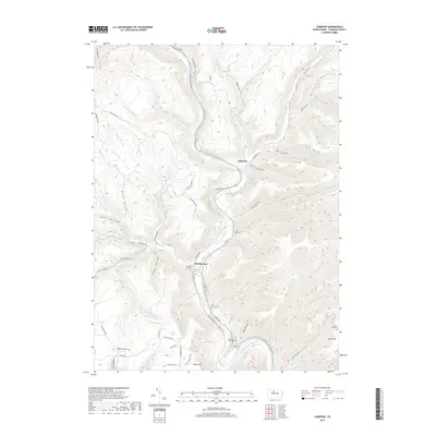
2019 Map of Cameron
USGS Topo · Published 2019About this map
Driftwood Branch Sinnemahoning Creek carves a central valley through this section of the Pennsylvania Wilds, dictating the placement of settlements and transport corridors. The village of Cameron occupies a narrow shelf at a sharp bend in the river, while Sterling Run sits at the confluence of its namesake tributary and the main branch. The landscape is defined by steep ridges and deep hollows, many bearing names that suggest the region's resource-based history, such as Stillhouse Run and Mooley Hollow Run.
Find a feature on this map
69 named features on this map. Tap any name to fly to it.
Don’t see what you’re looking for? This feature index may not catch every label — zoom into the map to look around manually.
Map Details
Editions of this 2019 Cameron Map
This is the sole edition of this map. No revisions or reprints were ever made.
Other maps of this area

1941 · Benezette
USGS Topo · 1:62,500

1943 · Benezette
USGS Topo · 1:62,500

1945 · Driftwood
USGS Topo · 1:48,000

1945 · First Fork
USGS Topo · 1:24,000

1945 · Sinnemahoning
USGS Topo · 1:24,000

1945 · Driftwood
USGS Topo · 1:24,000

1945 · Cameron
USGS Topo · 1:24,000

1947 · Cameron
USGS Topo · 1:24,000

1947 · First Fork
USGS Topo · 1:24,000

1947 · Sinnemahoning
USGS Topo · 1:24,000
Featured Places
- Cameron, Lumber Township
- Gibson Township, PA
- Lumber Township, PA
- Portage Township, PA
- Shippen Township, PA