
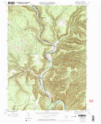
1945 Map of Cameron
USGS Topo · Published 1958About this map
The Driftwood Branch Sinnemahoning Creek carves a deep valley through this portion of Cameron County, dictating the development of the settlement at Cameron. In the mid-1940s, the Pennsylvania railroad and Pennsylvania 120 follow the narrow corridor of the creek, which is the primary artery for transportation between the high elevations of Shippen, Lumber, and Gibson townships.
Find a feature on this map
47 named features on this map. Tap any name to fly to it.
Don’t see what you’re looking for? This feature index may not catch every label — zoom into the map to look around manually.
Map Details
Editions of this 1945 Cameron Map
3 editions found
Other maps of this area

1941 · Benezette
USGS Topo · 1:62,500

1943 · Benezette
USGS Topo · 1:62,500

1945 · Driftwood
USGS Topo · 1:48,000

1945 · First Fork
USGS Topo · 1:24,000

1945 · Sinnemahoning
USGS Topo · 1:24,000

1945 · Driftwood
USGS Topo · 1:24,000

1947 · Cameron
USGS Topo · 1:24,000

1947 · First Fork
USGS Topo · 1:24,000

1947 · Sinnemahoning
USGS Topo · 1:24,000
1947 · Driftwood
USGS Topo · 1:24,000
Featured Places
- Cameron, Lumber Township
- Lumber Township, PA
- Shippen Township, PA
- Portage Township, PA
- Gibson Township, PA