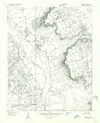
1955 Map of Cameron SE
USGS Topo · Published 1957About this map
The Navajo Indian Reservation landscape is defined by the winding course of the Little Colorado River as it carves through the high desert of Coconino County. This mid-century preliminary survey identifies traditional dwellings, marked as Hogans and a singular Hogan, scattered across the plateau and near the river's edge. The terrain is largely dominated by intricate drainage systems and dramatic elevation changes, with the Indian Reservation Bdy clearly delineated in the south. Notable survey markers like Bench VABM 4785 provide precise vertical control points in this isolated region, where the primary infrastructure consists of unimproved roads and seasonal water sources like the northern Pond. This map captures a moment of transition during the mid-1950s, documenting indigenous settlement patterns before more modern developments altered the local geography.
Find a feature on this map
7 named features on this map. Tap any name to fly to it.
Don’t see what you’re looking for? This feature index may not catch every label — zoom into the map to look around manually.
Map Details
Editions of this 1955 Cameron SE Map
This is the sole edition of this map. No revisions or reprints were ever made.
Other maps of this area

1886 · San Francisco Mtns
USGS Topo · 1:250,000

1891 · San Francisco Mtns
USGS Topo · 1:250,000

1894 · San Francisco Mtns
USGS Topo · 1:250,000

1899 · San Francisco Mtns
USGS Topo · 1:250,000

1947 · Flagstaff
USGS Topo · 1:250,000

1954 · Flagstaff
USGS Topo · 1:250,000

1955 · Black Falls NE
USGS Topo · 1:24,000

1955 · Cameron SW
USGS Topo · 1:24,000

1955 · Cameron
USGS Topo · 1:62,500

1958 · Flagstaff
USGS Topo · 1:250,000