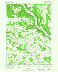
1953 Map of Cameron
USGS Topo · Published 1967About this map
The Canisteo River carves a deep path through this corner of Steuben County, where the Erie RR follows the valley floor past the hamlets of Cameron and West Cameron. This 1953 field-checked study reveals a landscape defined by high ridges and narrow creek valleys, where small settlements like Boyds Corners and Hedgesville served as local hubs. The abundance of upland burial grounds, including the Eight Square Cem, North Jasper Cem, and Clark Cem, suggests the area's deep-rooted agricultural history and the distributed nature of its early nineteenth-century farmsteads.
Find a feature on this map
32 named features on this map. Tap any name to fly to it.
Don’t see what you’re looking for? This feature index may not catch every label — zoom into the map to look around manually.
Map Details
Editions of this 1953 Cameron Map
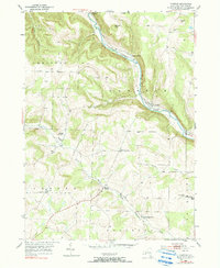
Other maps of this area

1910 · Bath
USGS Topo · 1:62,500

1915 · Hornell
USGS Topo · 1:62,500

1918 · Hornell
USGS Topo · 1:62,500

1924 · Woodhull
USGS Topo · 1:48,000

1926 · Woodhull
USGS Topo · 1:62,500

1926 · Greenwood
USGS Topo · 1:62,500

1944 · Woodhull
USGS Topo · 1:62,500

1950 · Elmira
USGS Topo · 1:250,000

1953 · Cameron
USGS Topo · 1:24,000

1953 · Woodhull
USGS Topo · 1:24,000